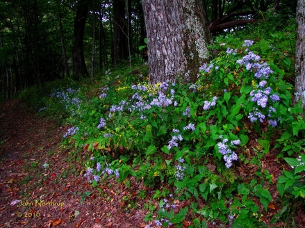
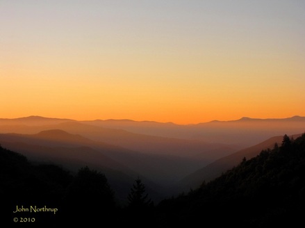
Well, after yesterday's hike, I have to admit, I was feeling really good. I thought I might be exhausted but I figure I was in better shape than I gave myself credit for. I had an itch to get in another long hike today, if not over twenty miles again, I was feeling that good. My heart wasn't set on anything yet so I looked over my map for gaping holes. Immediately, my eyes became fixated on Deep Creek. I continued to ignore that area of the park for some reason, possibly because of the drive. Anytime I had hikes planned for there earlier in the year, I'd find a way to back out of it and end hiking elsewhere. Well, enough was enough, so I decided to buckle down and do a long loop hike. There was a chance of rain in the forecast, so I knew things could get messy along the way, but I was willing to give it a shot.
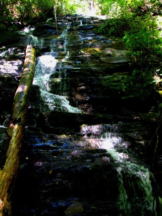
There were a number of ways I could have gone about this one. There are several trails that parallel and intersect each other as they cut of the river valleys or ridge lines, all running north and south. I figured I would keep my elevation change down for the day by making a loop out of the Deep Creek and Indian Creek trails. At the trailhead, one can follow the short path up to Juney Whank Falls, but I wanted to get going on the big hike, electing to hit that waterfall at the end. Of course, I had a number of waterfalls to see this day because there are several all within short hiking distance of the campground. I made my way up Deep Creek and soon enough saw myself standing cross river from the amazing Tom Branch Falls. It is certainly one of the more picturesque water scenese in the entire park in my opinion. I also like the fact that it was located on the opposite side of the river so there weren't people climbing all over it. The park has made this spot very accomodating to visitors by clearing out any obstructions and securing several benches in which to sit, relax, and enjoy the falls.
There were a number of ways I could have gone about this one. There are several trails that parallel and intersect each other as they cut of the river valleys or ridge lines, all running north and south. I figured I would keep my elevation change down for the day by making a loop out of the Deep Creek and Indian Creek trails. At the trailhead, one can follow the short path up to Juney Whank Falls, but I wanted to get going on the big hike, electing to hit that waterfall at the end. Of course, I had a number of waterfalls to see this day because there are several all within short hiking distance of the campground. I made my way up Deep Creek and soon enough saw myself standing cross river from the amazing Tom Branch Falls. It is certainly one of the more picturesque water scenese in the entire park in my opinion. I also like the fact that it was located on the opposite side of the river so there weren't people climbing all over it. The park has made this spot very accomodating to visitors by clearing out any obstructions and securing several benches in which to sit, relax, and enjoy the falls.
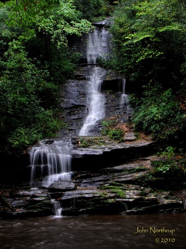
I was thankful that the rain hadn't come yet and I was able to take some great shots of the serene falls. Just a little ways up the trail I crossed a footbridge over Deep Creek and eventually came to a junction. I took the Indian Creek Trail to the right with hopes of seeing the next waterfall in good weather. Indian Creek Falls shows up but a tenth of mile past the junction and down to the left. It too is a fascinating water scene, much flatter than the previous Tom Branch Falls. The surface on which the water flows is an expanse of rock that could serve as a slide, though it might be a tad bumpy. I enjoyed it for a moment before finally making my way up trail again.
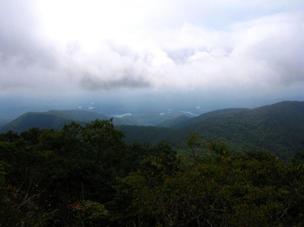
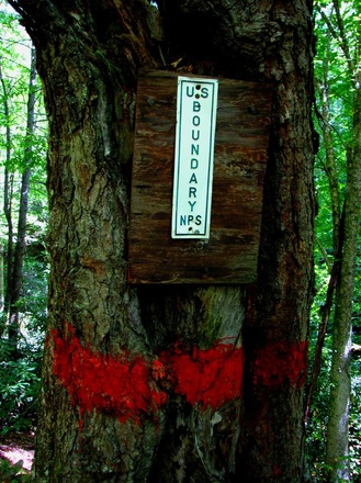
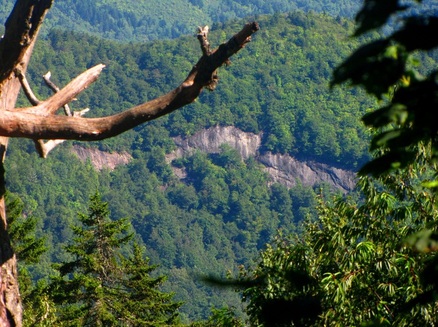
I was sensing a theme because I hadn't gone far when I reached yet another point of interest. Not sure how I would want to incorporate the one mile Stone Pile Gap Trail between here and the Thomas Divide, I figured I would do the up and back now and just get it over with. So I took the right at this junction, crossed the creek, and made the steep climb. Where this trail meets up with the Thomas Divide is at the park boundary next to mountain road for people's homes. The Thomas Divide Trail itself resembles an old road bed from what I could see in either direction. I didn't stay long, just enough to put the surroundings to visual memory and then make my way back down the mountain. When I reached Indian Creek I made a right. A person jogging had just crossed in front of me when I made the turn. I bet a lot of people enjoy staying at the campground and getting in a good run on these trails that are well graded, wide, and beautiful. I kept the runner in sight because of my own brisk hiking pace until I quickly reached the Loop Trail that would lead me up and over Sunkota Ridge.
The Loop Trail is decent climb over a short distance. The path is also in good condition. I bypassed the Sunkota Ridge Trail, which I could have easily taken north as part of my loop, but I'll save it for a later date. I quickly went down the other side of the ridge to be reunited with Deep Creek. I was going to take a right here and continue upstream which meant I was going to leave out the one mile stretch between here and the start of Indian Creek Trail. Depending on how I felt later in the day would determine if I made my way back here to finish it off. At this point I began to hear the pattering of rain on the forest canopy and felt sprinkles falling. I didn't have to go far before the trail that followed an old road bed narrowed into foot path.
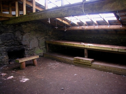
After scaling a small rise I arrived at Campsite #60. The rain wasn't about to let up and I had lost the enjoyment of feeling refreshed by its coolness. Time to throw on the raincoat. This would also mean the picture taking would be limited unless things cleared up. I still had another 3.5 miles to go until I reached the Martins Gap Trail. This is where things turned sour. Despite what the guide book showed in regards to the slight elevation gain up Deep Creek, the numerous ups and downs were torture. I was reminded of my first encounter with Deep Creek, that being the upper portion from Newfound Gap Road to Martins Gap Trail. The trail conditions were horrible to put it modestly. Having to fight through thorny blackberries, blowdowns, untamed rhododendron, other saplings, and spiderwebs while walking over mud, unbridged stream crossings, and rocks was the norm for that hike. The case wasn't much different in regards to today's section of Deep Creek. Rocks littered the trail and they were slick. Boards had been layed down in a few places but in a disorganized fashion. They were hazardous to walk on as well because of the wet surface. Here I was expecting a relatively flat walk until I reacehd Martins Gap, but the unrelenting ups and downs of the trail as it maneuvered between the rocky mountainside and the river were draining on mind and body. What made matters worse was that the rain got heavier the further I went. At several places I considered turning around, but I managed to talk myself out of it because why cover all the distance just to double back and not get new miles. So I pressed on in hopes that my turnoff was close. It just wasn't happening. Of all the hikes I had done up to that point, this single 3.5 mile stretch was taking the longest. If I were a movie critic and the name of the film was Deep Creek Trail, I wouldn't hesitate to give it a review of 0 out of 5 stars. I had enough of it and I still had a lot more ground to cover that afternoon.
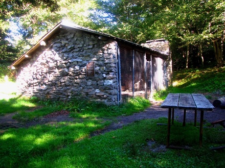
Eventually...and I mean eventually, I made it to Campsite #57 at Bryson Place. I had connected the dots and completed the Deep Creek Trail, except for that one mile bit near the campground. I did what I could to find a comfortable spot to sit and eat some lunch at one of the picnice tables. Trying to hold my coat over my food and eat while fending off spiders was quite a chore. After the break, it was time for some uphill. I had to once again scale Sunkota Ridge, but since I was further north, I had a greater climb to reach Martins Gap.
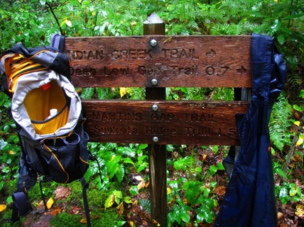
Anything that took place after this point is forgettable. There wasn't anything that great to see, nothing interesting was happening. Just rain. So I made my way up, then made my way down the other side toward Indian Creek. The intersection where these two trails meet isn't your typical one. Usually the come to a T or an X, but these two just oddly collide in the middle of the woods and a sign was put off to the side. Very peculiar. I was drenched, but the rain had begun to let up a little. I took off my pack and rain coat and hung them on the sign. Who knows, maybe they'd dry up and air out for me. HA!!!
I was sensing a theme because I hadn't gone far when I reached yet another point of interest. Not sure how I would want to incorporate the one mile Stone Pile Gap Trail between here and the Thomas Divide, I figured I would do the up and back now and just get it over with. So I took the right at this junction, crossed the creek, and made the steep climb. Where this trail meets up with the Thomas Divide is at the park boundary next to mountain road for people's homes. The Thomas Divide Trail itself resembles an old road bed from what I could see in either direction. I didn't stay long, just enough to put the surroundings to visual memory and then make my way back down the mountain. When I reached Indian Creek I made a right. A person jogging had just crossed in front of me when I made the turn. I bet a lot of people enjoy staying at the campground and getting in a good run on these trails that are well graded, wide, and beautiful. I kept the runner in sight because of my own brisk hiking pace until I quickly reached the Loop Trail that would lead me up and over Sunkota Ridge.
The Loop Trail is decent climb over a short distance. The path is also in good condition. I bypassed the Sunkota Ridge Trail, which I could have easily taken north as part of my loop, but I'll save it for a later date. I quickly went down the other side of the ridge to be reunited with Deep Creek. I was going to take a right here and continue upstream which meant I was going to leave out the one mile stretch between here and the start of Indian Creek Trail. Depending on how I felt later in the day would determine if I made my way back here to finish it off. At this point I began to hear the pattering of rain on the forest canopy and felt sprinkles falling. I didn't have to go far before the trail that followed an old road bed narrowed into foot path.
After scaling a small rise I arrived at Campsite #60. The rain wasn't about to let up and I had lost the enjoyment of feeling refreshed by its coolness. Time to throw on the raincoat. This would also mean the picture taking would be limited unless things cleared up. I still had another 3.5 miles to go until I reached the Martins Gap Trail. This is where things turned sour. Despite what the guide book showed in regards to the slight elevation gain up Deep Creek, the numerous ups and downs were torture. I was reminded of my first encounter with Deep Creek, that being the upper portion from Newfound Gap Road to Martins Gap Trail. The trail conditions were horrible to put it modestly. Having to fight through thorny blackberries, blowdowns, untamed rhododendron, other saplings, and spiderwebs while walking over mud, unbridged stream crossings, and rocks was the norm for that hike. The case wasn't much different in regards to today's section of Deep Creek. Rocks littered the trail and they were slick. Boards had been layed down in a few places but in a disorganized fashion. They were hazardous to walk on as well because of the wet surface. Here I was expecting a relatively flat walk until I reacehd Martins Gap, but the unrelenting ups and downs of the trail as it maneuvered between the rocky mountainside and the river were draining on mind and body. What made matters worse was that the rain got heavier the further I went. At several places I considered turning around, but I managed to talk myself out of it because why cover all the distance just to double back and not get new miles. So I pressed on in hopes that my turnoff was close. It just wasn't happening. Of all the hikes I had done up to that point, this single 3.5 mile stretch was taking the longest. If I were a movie critic and the name of the film was Deep Creek Trail, I wouldn't hesitate to give it a review of 0 out of 5 stars. I had enough of it and I still had a lot more ground to cover that afternoon.
Eventually...and I mean eventually, I made it to Campsite #57 at Bryson Place. I had connected the dots and completed the Deep Creek Trail, except for that one mile bit near the campground. I did what I could to find a comfortable spot to sit and eat some lunch at one of the picnice tables. Trying to hold my coat over my food and eat while fending off spiders was quite a chore. After the break, it was time for some uphill. I had to once again scale Sunkota Ridge, but since I was further north, I had a greater climb to reach Martins Gap.
Anything that took place after this point is forgettable. There wasn't anything that great to see, nothing interesting was happening. Just rain. So I made my way up, then made my way down the other side toward Indian Creek. The intersection where these two trails meet isn't your typical one. Usually the come to a T or an X, but these two just oddly collide in the middle of the woods and a sign was put off to the side. Very peculiar. I was drenched, but the rain had begun to let up a little. I took off my pack and rain coat and hung them on the sign. Who knows, maybe they'd dry up and air out for me. HA!!!
When I went to collect my things and begin the process of heading south, my camera was starting to have issues. It wouldn't turn on, then it wouldn't turn off, then it wouldn't access the memory card to show me the pictures I took. I was forced to pop the batteries in and out several times to try and get it start up. Eventually the entire thing just locked up and became useless. I'm sure you can just imagine the frustration I would have felt at this point. I'll spare you the unpleasantries. I had a feeling that all the rain and moisture may have had its way with my camera anytime I took it out of my pack to snap a quick photo of a sign. All I could do was put it in my pack and attempt to dry it out once I returned to the motel. Either way, it was not looking good at this point, and my day was pretty much ruined.
I wasn't even going to try and put on twenty miles today. I had decided that the small segment of Deep Creek I bypassed would have to wait for another day. I came to the junction with the Deeplow Gap Trail and took it a few tenths up to where it met the Indian Creek Motor Trail. This would help in terms of mapping out future loop hikes, the same reason I had done the Stone Pile Gap Trail earlier in the day. Future attempts to use my camera came up empty. I just made haste down Indian Creek back to the campground. Again, because of my state of mind, the rest of this hike was a blur. The rain had reduced itself to passing mists, so I could at least put my hood down without getting anymore soaked than I already was.
Before the end, I saw the loop trail that would take me up to Juney Whank Falls. I knew I wouldn't be able to take any pictures, but I wanted to finish the hike on a good note. It's a pretty steep climb up that particular way. I took a moment to appreciate the falls, then headed down to the parking lot to call it a day. I was able to accumulate a good deal of new miles, but I was left wondering if the cost at which I did it was too great. I was drenched and my beloved camera was ruined. I don't think I'll be looking to hike in the rain the rest of the year.

 RSS Feed
