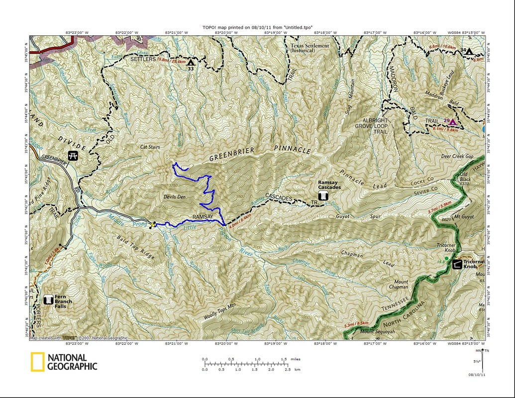
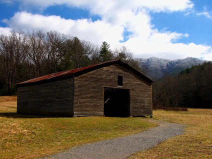
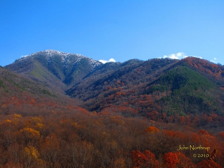
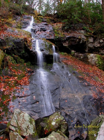
Entry about my bushwacking trek up to Greenbrier Pinnacle coming soon. 
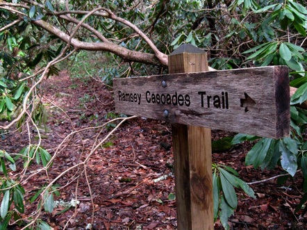
Choosing not to conform, I would hang a left under that lowered rhododendron. 
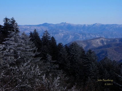
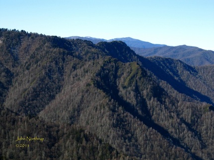
A view of Mount Kephart and The Jumpoff without obstruction, somewhere above Devils Den. 
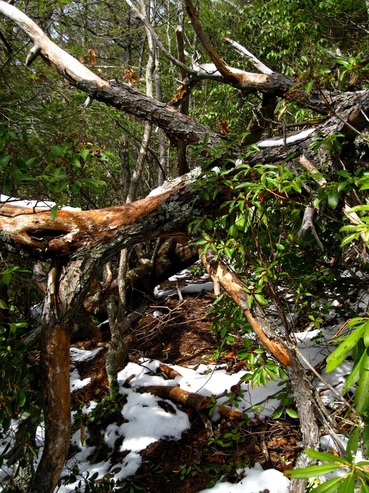
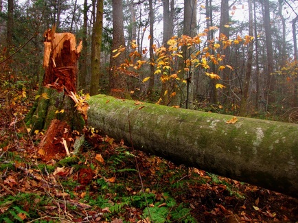
One of many blowdowns I had to navigate over, under, or around on this hike. 
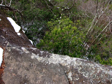
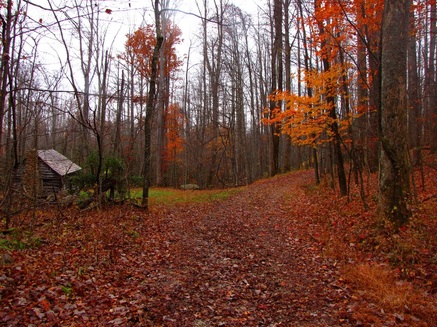
The trail skirts the edge of a rocky ledge before it turns into the woods for the remainder of the hike. 
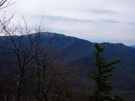
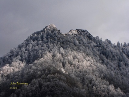
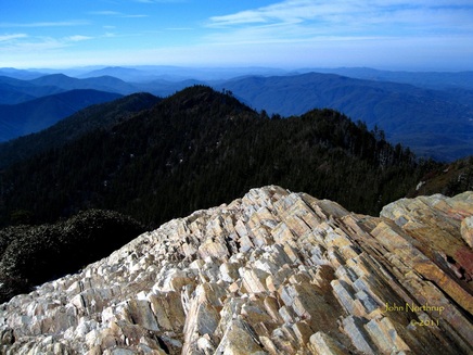
Though I could see Mount LeConte the entire way, this was probably the clearest view I could get through the trees. 
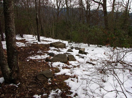
Broken chunks of concrete and foundation stones are all that remains of the old firetower.
0 Comments
Journal about my first hike of many the rest of the year, a 21 mile jaunt from Abrams Creek campground to Parsons Branch Road, coming soon! The drive along the Foothills Parkway was yet another fine winter wonderland. The long bridge that barely sits over Abrams Creek. A massive tulip poplar sits beside the path on Hannah Mountain. Plants in the shaded slopes were still stuck with snow. Near the beginning of Rabbit Creek Trail there were grand displays of daffodils. Today was to be our last full day in the park until our return for work in March. We had already thoroughly enjoyed our short visit, but in a way, it seemed as though something was missing. February is a winter month, yet it hadn't quite felt like winter, at least for me anyways. All along I was under the impression that it was early spring, determined by the mild temps, sunny skies, and apparent lack of snow. Sure there were some slicks patches here and there in the higher elevations, and Mt. LeConte had less than a foot on the ground, but without the snow sticking to the trees it was hard to believe that it was actually winter. Well, how's this for timing? That night a system passed through that saw flurries down low and a dusting of snow up high. So we knew as we headed out that morning that things were in our favor. Unfortunately, it was still cloudy and one couldn't see above 5,000 feet where most of the snow had fallen on all the mountain peaks. Our plan was to drive out to Cades Cove and enjoy the sights there, but with it clouded over, there wouldn't be much difference in what we saw when we were last there together in November. The weather forecast called for some sun to show up in the afternoon, so with hopes of the clouds either lifting or burning off, we decided to hit up Tremont first and do a short hike on the way. The drive out to Tremont was enjoyable and traffic was nearly non existent. The snowplows were just getting started on clearing the roads and Newfound Gap Road across the park was closed because of the freshly fallen snow. We had plans to drive that way later in the day, so we were hoping the conditions would improve on our return. Roads were somewhat slick during the approach to Fighting Creek Gap, but after that the roads cleared and the flurries in the air weren't able to stick to the pavement. During the drive out we continued to admire the clarity of the water that parallels the road. I also tried to picture what the roadsides would look like in another month or two when the wildflowers awaken from their chilly slumber and bring the park to life. The Spruce Flat Falls Trail was one I hadn't done before, but the pictures I had seen gave me the impression that it was one of the better ones in the park. I was in need for another new mile and this hike was a perfect fit for what we had planned for the day. One has to park at the GSMIT and walk a bit to the trailhead because of the facilities there and people's privacy. If you never been there before, look for "falls trail" signs where the service road terminates or at the beginning of the Lumber Ridge Trail. When we got out of the vehicle, it was a bit chilly, but once we got moving and our blood flowing, things would surely warm up. Right from the start the trail was covered in a thin but slick layer of snow. The way up has a number of switchbacks at first and requires a few yards worth of big step-ups. Careful footing was a must around log steps because they were especially slick and you could find yourself on your rear end in a hurry if caught unaware. There are a number of spur trails that may spark curiosity, but there are signs that point one in the right direction to the falls. After making our way around a small water tank, the trail cuts up and over the ridge, away from Tremont, and into the woods. It was such a relief to be in the woods and simultaneously exciting because of all the snow on the ground. Finally, a winter hike with the feel of winter! Some sections were a bit daunting like snow covered leaves still sitting on the trail, or the steps carved into a log that would work better as a launching pad for a sled. The trail itself, not marked on the maps issued by National Geographic, basically follows the gravel portion of the road through Tremont. The path sits higher up the hillside and is separated from the road by the Middle Prong which is easily heard below. At one point the trail swings around a corner and an opening in the trees offers a view up toward the surrounding ridgeline. The clouds were still solid across the sky, but they had risen just enough for us to see snow on the trees higher up. I tried to snap some photos but the cold air seemed to be having its way with my camera lens. It didn't bother me too much, because the waterfall was what I really wanted. The trail descends during the last couple tenths into a ravine that houses the falls and takes you right to the base. If one would rather drive along the gravel road below, the falls is visible from there but obviously much smaller. The water was pouring over the rocks intensely, similar to what we saw at Ramsey Cascades, so a long shutter interpretation with my camera wasn't going to work all too well. The rocks around the falls and its pools were wet, but not that slick, and the rhododendron were coated in light snow creating a neat winter scene. My camera continued to give me fits but I managed to get in a few shots before leaving. That was the bulk of our exercise for the day. Once we made it back to the vehicle, the weather conditions in our neck of the woods hadn't changed much. Still cloudy, no sun, and the peaks remained hidden. Who knows, maybe that would change a bit just during our drive from Tremont to Cades Cove. It was strange being at the cove this time of year. No traffic, bicycles, or hayrides. No families in the picnic area, campground, or store. I almost felt out of place...but only for a moment. It was a great feeling to know that I wouldn't have to contend with traffic going around the loop. Once we made our way deep into the cove and around the open fields, it was evident the clouds were finally beginning to break. They were slowly but surely lifting above the peaks and bursts of sunlight shot through gaps in the clouds and danced along the slopes. The highest of the peaks were the whitest while where we were in the cove was mild and dry like early spring. We parked the car and took the walk out to the John Oliver Cabin. On the way back, the summit of Pole Knob kept popping in and out of the clouds and the dense snow cover could be seen at its point. I could only imagine would Thunderhead, or even the higher peaks to the east like Clingmans Dome and Mt. LeConte looked like after that night's snowfall. We didn't stop much between there and the visitor center half way around the loop just because the cloud cover was slow to change and the views one gets to the south were getting repetitive. After a quick stop at the restrooms and Cable Mill area we were back on the loop. Now the clouds were really beginning to break, offering up more blue sky, warmer temps, and unobstructed views of the mountains. Rich Mountain which lies to the north was just about completely clear now and snow along its crest could be seen. The second half of the drive around the loop is a bit more wooded in places, but that doesn't keep people from stopping to take in the other sights of the cove, that being the wildlife. Our one jam of the day came in one of these areas where a few deer were hanging out by the road, sifting through leaves and watching cars. I managed to capture a shot of one deer in its dark winter coat as I waited for the car in front of me to continue on. We were stopping more frequently now because of the various homesteads along the route and their close proximity. I also felt the need to beef up my historic structures section on this site. It always seems like everybody and their brother gets the same pictures of these buildings, that's why I enjoy getting out in the backcountry to see the sights and capture images that hardly anybody sees. Nevertheless, I felt compelled to get several of the arbitrary shots this time around. One of the neater stops came at the Dan Lawson Place because the sun was really shining at this point and the surrounding ridges topped in snow served as a unique backdrop. We finished out the remainder of the Cades Cove loop having enjoyed our time there, but now we were eager to learn of the conditions of Newfound Gap Road. Surely if the higher peaks were blanketed in snow, if the skies were clear, and the road was open, we would be in for one heck of an afternoon for sight seeing. Much of the snow that we saw beside the road on our way out to Cades Cove that morning had already melted off, so that was a positive sign. Once we made it back to the Sugarlands Visitor Center, we rounded the corner with anxiety. Sure enough, the cones and signs had been pulled out of the intersection, the gate was open, and traffic was coming from both directions. My oh my, was the anticipation building. First up was Campbell Overlook. We couldn't see above Balsam Point which lies in the center because the clouds seemed to be hung up on Mt. LeConte, but snow could still be seen below the cloud base. It was about to get better though. What's great about the drive along Newfound Gap Road is that the views of so many unique landmarks are much more intimate, where in Cades Cove, the vast distance between you and the surrounding peaks makes it feel out of reach. Cue the drive below Chimney Tops. It is one of the more interesting landscapes in the park, and for good reason. In the spring, the heath covered slopes sport whites and pinks. In autumn, the valley explodes with vibrant colors. And in the winter, the exposed rocks shine above its steep slopes cloaked in white. I wouldn't be in any hurry to climb up there at a time like this, but it sure is a beautiful sight to behold. As we made our way past Chimneys, the snow on the ground was getting higher and the amount stuck to the trees was getting thicker. They had done a fine job of clearing the roads for traffic so there were no worries. Another bonus was that the clouds sitting between Sugarland Mountain and Mt. LeConte were about all that was left. The rest of the skies had cleared up for the most part, especially in North Carolina. Right before we arrived at Newfound Gap, the scenery continued to impress, turning our eyes as big as basketballs. The white of the conifers against the rich blue of the sky behind has such an incredible contrast. Everything just kept getting better the higher up we got. The views from the parking lot at Newfound Gap were as breathtaking as they've ever been, crystal clear and limitless. The white of snow was pristine and variances of blue in the mountains and sky were vivid. I had never been able to see that far with such great definition and clarity before from Newfound Gap. I was blown away to the say the least. We drove a short ways into North Carolina to check out the views from the first few vistas at Luftee Gap and over Deep Creek. They were equally as impressive. The fact that it was incredibly cold anytime we stepped out of the vehicle was easily disregarded because of the excitement and satisfaction. It was difficult to leave such beauty behind, but we were so grateful that our last day in the park for a month gave us that winter fix we were hoping for. Today was a merely the culmination of a fantastic getaway that once again served as a reminder of why the mountains are home.
After yesterday's long though enjoyable day hike up and down Mt. LeConte, we weren't in any hurry to exhaust ourselves with another long hike. Since there was a chance of rain coming in the afternoon, we also didn't want to get caught out somewhere. Add yet another factor to our decision making, we didn't want to just sit around all day, especially because the weather had been so great, contrary to what the forecasts were calling for. So a short morning hike that was close by was in store. We figured the Gatlinburg Trail and a few of the nature trails around the visitor center would be enough to satisfy our need for exercise and be completed before lunchtime. Anyone who has done the G'burg Trail starting from the edge of town knows that it soon passes by the famous sign at the park entrance. We stopped for an arbitrary shot which worked out great because this time of year there are no crowds or traffic to disrupt the photo! We passed a few people along the way, either out walking a dog, getting in a routine jog, or just enjoying the nice weather before the rain like we were. The walk was pleasant, nothing but the sounds of the wind, the birds, and the river. As before, we were amazed at how clear the water was. This time of year you can see straight to the bottom and pick out all sorts of amazing colors. The variances in green were quite interesting. As beautiful as it was, we were in no hurry to jump in. I think we'll save that for the heat of summer.
When we reached the visitor center, we took the turn for the Fighting Creek Nature Trail that wanders through the woods highlighting different trees. One eventually comes out at the sight of John Ownby's Cabin. It had been a long time since I had been back here, although my family has some fond memories of this place. None of which I will mention here, but it was interesting to relive said experiences as I stepped inside the cabin. Shortly after we left the cabin and made our way around the rest of the loop hike, we stumbled upon a large gathering of turkeys. They seemed unalarmed by our presence, so we watched them from the trail for several minutes. We counted about twenty turkeys in all. On our return trip we took the detour to Cataract Falls. Bonnie had never seen it, it was close by, and there was no sign of rain, so we gave it a go. Not the most impressive of waterfalls in the park, but still one to be appreciated. We eventually made it back to town unscathed and grateful that we got in some exercise. At least this way we wouldn't feel guilty spending the rest of the day being lazy. Coming into this trip, we had it set in our minds that we would like to make a trip up Mt. LeConte and pay a visit to the lodge in its winter dormancy. Of course, the biggest factor in our decision making was the weather. If it was snowing or raining during our time in Gatlinburg, or if the trail conditions were hazardous or impassable, then we weren't going to bother with it. Fortunately, the weather on our second day was supposed to be our best day, with spotty morning fog giving way to clear and sunny skies. Combine that with the fact that snow totals atop the mountain were under a foot and all cables clear, we saw a great opportunity to get some work done and enjoy ourselves in the process. So it was an early morning start into the park after fueling up on some donuts. We drove through some patchy fog before the reaching the trailhead, but it was dissipating for the most part. What was really neat was that the condensation from the fog stuck to the trees in the shaded areas and froze, giving them a nice shiny look. So many of them glimmered in the morning light passing through the valley. Reports told us that despite the recent nice weather, Alum Cave Trail was icy from top to bottom. This could be extremely dangerous for anyone not properly equipped with some sort of cleats for boots. Having worked at the lodge, we were both prepared for the conditions ahead and came along with our "stabilicers." We'd use them the entire way which in turn made our trek pass with ease. There is no substitute for sure footing when it comes to hiking this time of year. A great deal of time and energy can be wasted trying to navigate around snow and ice without the proper footwear. As soon as we crossed the first bridge over Walker Camp Prong, we were greeted with a sheet of packed snow. The stretch of trail between the parking lot and Arch Rock saw a number of downed trees blocking the trail. We weren't the first hikers to stumble across them because limbs had already been snapped to form a tunnel through the tangled messes. Hopefully they'll be cleared by trail maintenance crews before we have to return to work in March with our much larger packs. Since the trail parallels the creek for the first part, we were quick to notice how clear that water was like we had yesterday. It must have to do with the cold or the snow melt. I remember making the same observations hiking up this very same trail last year in March. Maybe it has something to do with the lack of foliage as well. Before we reached Arch Rock we finally broke out of the shade and into the sunlight. Immediately I felt myself getting warmer and decided to stop and shed layers. Despite the cool temps and the presence of snow, it is important to shed layers during your ascent. You do want to work up a sweat because as soon as you stop, all that water on your skin and in your clothes will make your body too cold and/or too fast; thus, encouraging hypothermia. Since you are moving constantly, your blood flow will do enough to keep your body warm even in a short sleeved shirt. If you do decide to stop for a little bit, then it would be wise to put your dry layers back on and maintain your warmth. We stopped long enough to remove one layer and get a drink of water, then it was back to moving. Arch Rock, with all of its constant shade, was pretty well iced over on the inside. Luckily, the steps were clear, but it would have been a mess if they weren't. Somewhere in the half mile between Arch Rock and Inspiration Point we came across a rocky outcrop that sees a lot of water runoff and sits in the shade. Its surface was coated in icy columns, several of which had broken off due to the warming temperatures of late. There were at least three massive pillars of ice that had disconnected from the others and fell right onto the trail. The chunks themselves were still intact and looked rather impressive. By the time we had reached Inspiration Point, all of the fog had burned off and the skies above were clear. The views were also astounding as far as we could see. We had passed a handful of hikers along the way, some of whom had stayed at the backcountry shelter the night prior. We were high enough in elevation now while being on the south side of the mountain that the sun had done a decent job of clearing the path of snow before the bluffs. We were glad to see that the notorious, car-sized icicles that fall from the bluffs had already thawed and gone. The only ice remaining there was a glaze on the rocks directly below where water constantly trickles down from the top of the bluffs. We saw one more group of backpackers here and they would be last people we came across the rest of the afternoon until our return. Once we made our way around the north side of Peregrine Peak and past the halfway point, we were back to walkin on snow and ice. No worries though because our stabilicers were holding up just fine. The rest of the way up Alum Cave was as monotonous as ever, walking through the woods, heading in the same direction, stepping over rocks, roots, and snow. The most entertaining part was when I come across snow that was in the sun and had become packable. I'd look back at Bonnie, and if she was far enough away I could roll up a snowball real quick without her noticing. After a few close calls she finally caught on to me and made me stop. I would comply...until later...haha! Anyone who's done the hike up Alum Cave to Mt. LeConte knows that the views get better the higher you get. Some of the best places are at the rockslides below Cliff Tops that afford grand views of the Smokies main ridge and the valley below. The view of Chimney Tops was especially clear this day. Having done this particular hike over a hundred times, I know exactly where I'm at and what to expect the entire way up. That's why it's always such jubilation when I reach the crest of the mountain at the old horse gate a quarter mile from the lodge. After that point, the rest of the trail is flat. Neither of us had ever been up here at this time of year, but because the snow totals were on the lower end this winter, we weren't seeing anything we hadn't already seen before. The mountain looked like it typically does in March or November. Yeah we were hoping to get to experience Mt. LeConte in all its winter wonder, but we were pretty ecstatic about being able to reach the top without a scratch. It was an undescridable feeling to reach the lodge and see all the cabins again after two months. It truly felt like we were back home. The place we had come to know and love was still there waiting for us. As we stood at the top of camp and looked out, the entire valley to the north was below the clouds and here we were above it all. What made it so unique this time around was that we had it all to ourselves. Alex, the winter caretaker was off the mountain for the afternoon tending to some business in town, so not even he was there. There were no dayhikers, no shelter folk, and no guests because the lodge is closed. It was so quiet, and calm, and perfect. It was just Bonnie, me, the mountain, and a gorgeous day. How cool is that? Our other reason for bring there was to make some preparations for this upcoming season since we are both returning. We tended to some things regarding our respective crew quarters after we warmed up in the kitchen and ate some chow. When we finished with our business, we wanted to make a brief stop at Cliff Tops. Since it sits on the mountains southern face, it loses its snowpack the fastest, so all of the jagged rocks were dry and bare. Looking around, there wasn't much snow to see because all that remained was on the ground and not on the trees. The views were delightful and the mountains in the distance were in varying shades of blue. It was difficult to leave, but we knew we didn't have much daylight so we had to head down eventually. We never saw anybody the rest of the way down between the lodge and the bluffs which we found interesting given that it was such a beautiful day. Oh well, guess everybody missed out except us! It was incredible to see the lodge again, but we won't be back again until another month. Hopefully this trip will be enough to hold us over.
And so it begins! The 2011 hiking season that will see my journey across the Smokies take me to new and unforgettable places is here! After a two month hiatus, my first hike in the park couldn't come soon enough. As much as I would have loved to bust open the gate with a twenty mile hike in uncharted territory, my body that has been growing bigger and lazier since the holidays would not allow it. Plus this trip was planned with the intention of relaxing and simply getting back in touch with my mountain home. It also fell in the middle of roadtrip with Bonnie, on our way from Georgia the last week to Michigan the upcoming week. As for specific hikes, we had no plans other than a possible return to Mt. LeConte. We were going to play each day by ear in terms of the weather and how we felt after months of hiking inactivity. Today saw a pleasant winter afternoon with sunny skies and moderate temperatures. We wanted to do something exciting that would also take advantage of the weather, but not too long as to sap us of our strength so soon. We soon found our hearts set on venturing out to see Ramsey Cascades. It was one she was eager to see for the first time, and it was one I was hoping to revisit after several years. I originally had it planned as a hike last year but elected to scrap it from my schedule in order to attain new miles. So today looked like the perfect day! After a stop to the visitor center, we learned that the entire road out to Greenbrier was open. This time of year one can't be too careful in making preparations for being out in the backcountry. If roads or trails are in bad shape and you are caught unaware by the elements without the proper gear or mindset, you could be in serious trouble. My biggest worry at the time was the potential for snow and ice on the unpaved roads. Yes, I had 4WD, but sometimes these mountain roads get high up with steep dropoffs and no guardrail. Fortunately, the road out to the trailhead was completely open, though the mud did do quite a number on my vehicle. When we parked and got out into the open air, it was a little cool, but hitting the trail and getting the blood flowing would resolve that in no time. Immediately the trail crosses the river and leads you on your way around Greenbrier Pinnacle. The water below us was raging from the snowmelt and the numerous pools between the rocks were clearer than diamonds. Such a quality was one I remembered from my hikes last March when things were still cold and snow covered. For whatever reason the water becomes darker and dirtier in places during the warmer part of the year. The first mile and a half, an easy and gradual climb follows an old roadbed to a traffic circle. At this point the old Greenbrier Pinnacle Trail begins to the left and the way to Ramsey Cascades continues straight ahead. The pinnacle trail is no longer maintained by the park because of the introduction of peregrine falcons there. The firetower at the summit has long since been removed as well, but the path is still a favorite for many hikers. I made the climb one rainy summer day a few years ago and thoroughly enjoyed the views frmo the rocky outcrops. Know this: it requires a good deal of bushwacking and hurdling over blowdowns, but the path is still easy to follow. I failed to complete the last few tenths to the old firetower site, so I'll need to do that hike again someday. As for Bonnie and I, our task at hand was to make the climb up to Ramsey Cascades the steepens exponentially the further along one gets. Just over a mile past the old traffic circle, the trail passes between and under two massive tulip poplars spared from the logging days of the mountains. A few yards past the first two stands another bohemoth of a tulip, much larger than the others. All three are impressive and easily dwarf the other trees in the vicinity. It's always neat to compare yourself in size to one of these grand wonders. We had hiking for a while now and had begun to warm up considerably, so we shed a layer before continuing on. The remaining mile and a half to the cascade is persistent with its ascent as it criss crosses the Ramsey Prong over footbridges and rock hops. Despite the moderate temps and abundant sunlight, the shaded areas of the trail, particularly those along the northern sides of ridges, still had a lot of snow and ice. The higher we got, the more snow and ice covering the trail. We both had our stabilicers but we felt compelled to press on, skipping from exposed rocks and patches of dirt. Sometimes there was nothing but ice so we needed to take slow and small steps while clinging to nearby rocks or saplings. The rushing water grew louder and we eventually rounded a corner that brought the cascade into view. At that point our excitement level and gratification skyrocketed. The water was launching over the jumbled boulders that compile the cascade. The sun was shining in, but the shaded areas beside the falls still housed large columns of ice. At the base of the falls was a faint and tiny rainbow, hard to pick out with a camera. When we arrived we were plenty warm, but once we stopped moving to enjoy the cascade, the spray from the gushing water and wind funneling through the valley started to cool us down rapidly. I took as many shots as I could before my hands started to feel the chill. As beautiful as it was, and as much as we desired to stay, the unrelenting cold of the falls eventually drove us back into the woods and on our way. Since the last mile before the cascade was buried in snow and ice, we decided to strap on our stabilicers to sure up our footing and enable us to move quicker through those sections. Those cleats are thing of wonder! They always hold up on the snow and ice and have come in handy when working up at Mt. LeConte. I would highly recommend them to anyone interested in winter hiking in the Smokies on trails with hard and slick layers of snowpack. Obviously if you're looking to hike in deep, fresh snow, then by all means go for the snow shoes.
The hike back toward Greenbrier was uneventful and enjoyable. It was such a pleasant experience to be back in the park, out in the peaceful forest, basking in its beauty. It was also great to finally get off my rear end and get some exercise for the first time in two months! Greetings to all of you who grace "Smokies Stories and Glories" with your presence. I just wanted to update all of you about what's been going on. Hiking in the Smokies for the year 2010 is complete. My boots and I will be on hiatus for a while until early February when I'll make a brief return for some winter hikes. I also plan on returning to work at LeConte Lodge another season starting in March. I will also continue my quest to traverse every trail in the park. I have fallen behind on the last two month's entries because of the many distractions and obligations I had near season's end, and now that I'm back in Michigan. I promise you...I will get them written as soon as I can, which will probably start after New Year's. I will also change little things here and there on the site as I see fit regarding pages and photos. With that said, I would encourage you all to continue to enjoy the numerous photo galleries here on the site and past journal entries. If you have any questions or comments regarding the Smokies, my past hikes, or LeConte Lodge, please feel free to contact me and I will respond as soon as I can. I can be reached at [email protected] regularly.
Thank you all so very much for joining me on this journey throughout our beautiful Smokies. It truly is a wonderful place that I hold very close to my heart. I can only hope that my appreciation and experiences of the park's amazing beauty enhances those of yours. I wish you all a safe and joyous Christmas, New Year, and winter season. Thanks again and God bless! Yesterday afternoon and evening we received some rainfall down in the valley. With the overnight low gettin below freezing, that would likely mean the upper elevations saw snow. Sure enough, when I woke up that morning and made my way up through the park, Newfound Gap and above had a coating of snow on the ground and trees. I was looking to pick up where I had yesterday in terms of checking the various nature trails and quiet walkways. I had completed the Tennessee side of Newfound Gap Road, so my plan today was to do those that remained on the North Carolina side. The subsequent new miles would also be enough to get me to my 600 mile goal for the year. Despite the snow on the roads, the way up to Clingmans Dome was still open. I only needed to go as far as the Spruce Fir Nature Trail, though, and the dome itself was sitting in a cloud that hadn't yet burned off. I parked at the trailhead and made my way around the short loop. Compared to the trails yesterday, this one was immaculate. Nothing was overgrown, the path was obvious, and a number of boardwalks had been installed to bypass muddy patches. Very thoughtful on behalf of the park service. Everything in the woods was blanketed in white and the boardwalks were somewhat slick. A number of the branches were hanging low, so when I didn't lean enough to get under them, I ended up getting snow down the back of my shirt. Before I left this nature trail for those next on the list, I took a few pictures of the dome road while the snow was still there. It was obvious that as soon as the sun would hit it, the snow would quickly disappear. I was planning on coming back to the mountains after Thanksgiving, but I wasn't sure if I would see snow again until next year. I made sure to look around and enjoy it before hopping back into my vehicle. There are two quiet walkways in the vicinity of the vistas overlooking Deep Creek. One heads downhill abruptly to unite with the actual Deep Creek Trail. It may have been a second access point at one time. Either way, this path was atrocious. It should either be tackled by the maintenance crews or flat out condemned. Blowdowns were everywhere, the overgrowth was annoying, and deciphering where the trail was had become problematic. Thankfully it was short and I was able to reach Deep Creek Trail, but I don't think I'll ever take that way again. The other nature trail that starts just a little ways down the road was much more enjoyable. It was one of those that didn't have an end point, so it was up to the hiker to measure distance and decided when to turn around. It follows the crest of Shot Beech Ridge and the openings between trees are wide. When I chose to make my way back, I think I had gone farther than the distance provided on the map. I easily could have continued downhill because the grade was so gradual and the way through the trees so open. I wonder if it's possible to take the entire ridge down to Deep Creek without ever having to fight through the brush. I guess I'd save that answer for another day.
Next up was the quiet walkway that simply follows the old Newfound Gap Road. This would be the line cutting across the Thomas Divide one would see from the overlook at Newfound Gap in the fall or winter. You could probably hike the old road from Newfound Gap down to where it comes out at the current one. Depending on what direction your coming from, you'll see a grassy opening and a gate off into the woods. This would be where the old road came out. After that it was down to the parking lot for the Kanati Fork Trail. The quiet walkway that leads away from the main trail on the opposite side of the road is very short and merely takes you down to the river. I literally blinked and had this trail done. I was then planning to do the first part of the manway that leads up from Collins Creek campground, but I made a mistake and didn't realize that the campground was now closed. So all that I had to do now was the section of horse trail from the Smokemont entrance to the Bradley Fork trailhead. If you're someone who is crossing the Smokies by way of the Benton MacKaye Trail, you likely either take this connector trail or just follow the road through the campground. I would recommend the road because this was a horse trail...and muddy. Either way, it's behind me now. I had seen enough hiking for the day, if not for the year. I had finally surpassed the 600 mile mark out of all the trails in the park. I had also brought my total number of miles hiked for the year to 1,300. Whew! That's a lot of hiking in less than nine months. I certainly had a blast doing it all, and I can't wait to pick up where I left off next season. Hopefully I'll be in good health and find a way to complete all of the remaining trails in the park. Until then, it's time to head up the mountain one more time then take some time off for the holidays. Thanks for joining me on this incredible journey, and I'll look to keep it going next year! It was getting late in the year and the 2010 season on Mt. LeConte was about to come to a close in another week. I would be chasing a lie that I wasn't ready to take a break from hiking as well. I was nearing my goal of eclipsing the 600 mile benchmark out of all the trails in the Smokies. The thing was that I didn't want to do anymore long hikes, long drives, or any more climbing than what was needed to get me up and down Mt. LeConte one more time. Now I recently gone to a hiking store and picked up the National Geographic maps of the park that split it in two halves and thus offer a more detailed topographic interpretation. It also provided the locations and distances of a few more trails, specifically the numerous nature trails and quiet walkways. Anywhere you drive through the park you are bound to see one beside the road. They are meant for people who are looking to get into the woods for a short time but not stray too far from the vehicle or get bogged down in some strenuous hike. Well, I did some calculations and determined that if you combine the distances of all these trails, you get about 15.5 miles worth. That's a good portion of trails in the grand scheme of things. I've decided to include them in my quest for completing the park because they fit the main criteria...they are marked on an official park map and the trailhead have signs. Good enough for me! Since they are each short individually, I would need to knock out several of them in one day to get the miles I desired. This would require a lot of driving and getting in and out of the car. Nevertheless, I was up to the task. Now a number of them I had already done in years past, such as Elkmont, Cosby, Sugarlands, and Smokemont, so I had a good start. My plan this day was to hit the three paths between the visitor center and Elkmont first. So one by one I parked at each of the respective pulloffs, wandered into the woods til I found trails end or completed a loop, then came back. With all the leaves down, some of the paths were confusing. I ended up climbing a hill to find a cemetery on one of them. And the trails that weren't loops sort of just fizzled out and I was left to assume that I had reached the end. Here I am an experienced hiker and the description for these trails talk about people being able to relax and enjoy an easy walk in the woods. I was beginning to wonder. Next up, I was going to complete the stretch of trails that connect at various points along Newfound Gap from a pulloff before the Huskey Gap Trail to another just past Campbell Overlook. There are four possible entryways leading down to a main path that parallels the West Prong of the Little Pigeon River. Some of the paths follow old road beds, pass between the locations of old settlements, and cross small footbridges. But don't let any of that fool you, because the majority of these trails are a joke. The conditions were awful because finding the actual trail was next to impossible. A trail meant for any tourist to enjoy a casual stroll was quickly becoming a chore and a dilemma. The freshly fallen leaves probably hid the path in places, but there were numerous blowdowns and creek crossings. On various occasions I thought I was following a path when in reality I was just wondering through the woods. I did my best to stick with the river and keep an out for the vehicle pulloffs up above. I did take some time to move closer to the river and admire the rushing waters brought on by the previous night's rain. The boulders, falls, and pools were large in this one particular area. I'm not sure how I managed to come out to the road at each of the four correct points, because I truly guessed on two of them. When I reached the southern terminus of the trail, I just decided to take the road back to my vehicle and not even screw with going back that way. Quiet walkway and nature trail...yeah right. I still had the northernmost quarter to do because where I parked was at a fork in the trail. I took the right to start which brought me south, so now I had complete the other direction. Somewhere along the way I astonished by what I saw. Sticking out from the leaves were a number of blue violets. Here it was in the middle of November. I'm guessing that a recent warm spell confused the wildflowers into thinking it was spring again. Talk about a rare and pleasant surprise. When I finished that particular nature trail, I had seen enough. I was closer to the 600 mile mark and that was just fine. Tomorrow's forecast looks to be better, so maybe I'll give the nature trails on the North Carolina side a shot. Here's to hoping that they're in better shape.
My last days off the mountain were here. The fall season was fizzling out and my nine month hiking blitz was winding down. I still had some work to do in order to reach my 600 mile benchmark regarding all the park's trails. The forecast today called for rain in the afternoon, so I didn't want to drive very far or hike a great distance as not to get caught out in it. I still saw some viable options in the Cosby area. I had been putting off the Gabes Mountain Trail on a number of occasions, so now seemed like a great opportunity. Depending on how I felt and what the weather did would determine the rest of my route after completing the entire stretch across Gabes Mountain. If my body was feeling energized when I reached Maddron Bald Trail, I would head uphill sharply and form a loop hike with Snake Den Ridge. That would be a lot of work, so I wasn't committed to it. The other option would be much shorter and easier, taking Maddron Bald downhill to its trailhead and back. When I arrived at the Cosby campground, I was the only one there. The campground itself was closed for the winter, and the tourists had basically disappeared after Halloween. Combine that with the chance of icky weather, it all made sense that I had the region to myself. The first part of Gabes Mountain Trail heads uphill most of the way, crossing creeks on footbridges or rock hops. Many of the crossings were picturesque with fallen leaves stuck to the boulders in the streams. At one point, an unmaintained path cuts in from the right. This used to be an old road that came up from Cosby and served as the old trail to the popular Henwallow Falls. The trail detours a few massive, natural rock walls covered in leaves and moss. It then scales a small ridge before coming to a fork that leads one down to the falls. Henwallow Falls is situated in a steep drainage along the mountainside. Since the canopy was completely bare, I could see through the trees and pick out Cosby and other homes in the valley. It's something that I never really thought about until that moment, but where else in the park can you go to a waterfall and also have view. Even though the falls is spindly compared to others in the park, perhaps it's this view that makes it so popular. There are a good number of boulders below the falls appropriately placed for viewing, resting, and snacking. After a brief photo session, I returned to the maing trail continued west. The trail then goes above the falls, hits a switchback on a ledge, then ascends steeply. The rest of the way is mostly spent in the woods, so the views are limited. Gabes Mountain Trail weaves in and out of ravines and ridgelines. Not long after the falls, it reaches its crest in terms of elevation change and follows a pretty consistent contour. Just before arriving at Campsite #34, I had to navigate a large blowdown blocking my way. It was recent fall as I could tell from the fresh smells of broken wood and the bright coloration of the interior. There was no way over or under this one, so I had to wander through the brush and around the severed trunk to get back on track. The trail then dips down into a broad drainage, crosses a creek, and comes out at the campsite. There are terraced lots on either side of the creek. It looked like a very pleasant area to spend some time in the wilderness. It's a quick up past the campground that is short lived. The trail then makes its way down the slopes of Gabes Mountain in a gentle serpentine manner. After the descent, I came out to a very open intersection with Maddron Bald and Old Settlers trails. There were a couple of carved out benches for weary hikes and several trail signs directing the confused. I heard rumbles of thunder not long before then, so I eliminated the longer loop hike option. I was going to turn right and continue downhill alond the wide, former roadbed of Maddron Bald toward the park boundary. It comes out near a campground and neighborhood notorious for auto theft and break-ins, so avoid parking your vehicle there when doing this section of trail. The path down from the junction is very gradual, and in a short time bypasses the Baxter Cabin. It sits off trail to the left in an open, grassy area all by itself. It's a very simple square building compared to the other cabins being preserved across the park. Past the cabin, the landscape doesn't change much. Toward the end you begin to see houses and side streets before finally coming out at a back road. A sign there warns hiker about locking their vehicles and taking all valuables with them, and for good reason. I looked around real quick then headed back on up.
The return hike was just that, a repeat of everything I encountered coming out. Clouds were dropping lower so the views I had near the falls were gone. The rumbles of thunder continued. Now there are two trailhead for Gabes Mountain if you come from Cosby campground. The way I first took begins at the parking lot, while the other leads south toward the campground. To be sure and get all the new miles I could, I took the alternative. I also needed to finish up various portions of the horse trail that follows the circumference of the campground, so I literally took the long way back to my vehicle. In the process of extending my hike, it finally decided to rain. It never got heavier than a shower and it fely refreshing. I managed to rake in a few more tenths, but I was still a good deal shy of the 600 mark. It would have to wait til tomorrow. Hopefully the sour weather wouldn't stick around. |
Thanks for visiting!I appreciate you stopping by. This site is for your enjoyment as much as it is mine. Look for new photos and journal entries about every 1-2 weeks. Archives
November 2011
Categories
All
|